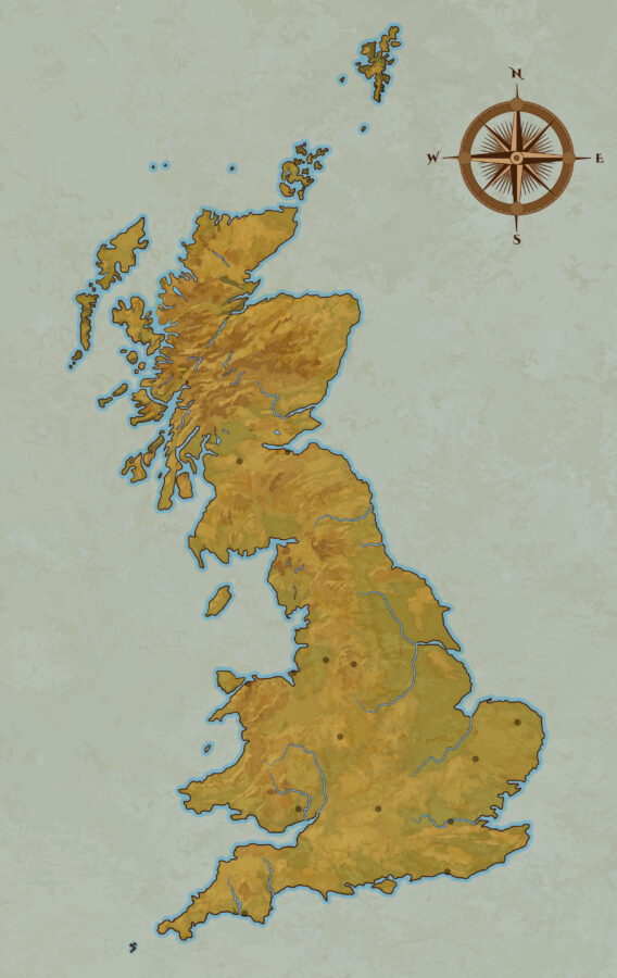
Time for stop 3 on our tour of the authorial wiki, maps! Today we’re going to look at two sets of maps, one for Albion as a whole, and one for Trellech, the main magical city. My maps are by Michael MB, who did a fantastic job taking my sketches and making them usefully informative.
The maps
Right now, there are two maps. One of the great tools in WorldAnvil is that I can put markers on the map that link to a page about that place. This may appear in a sidebar, or it may appear below the map, depending on what sort of device you’re using.
The locations of the markers are somewhat approximate, but should give you a general idea where things are located, what’s close by, and what’s further away.
Albion
Albion is basically Great Britain, which is to say, England, Wales, and Scotland. (Ireland is doing its own thing.) There are, however, things on the map of Albion that aren’t on our maps of Great Britain.
Most notably that island in Cardigan Bay, off the west coast of Wales. See the point of land sticking out at the bottom left? That’s Cornwall. Go up to the next bit sticking out to the west, that’s the bottom of Cardigan Bay. Schola – that island – is just above it.
The map also has a few subtle dots that indicate some locations (mostly cities) to help me locate places more easily. (And of course, some of those locations also are where specific stories take place.)
Explore the map of Albion. It includes markers for:
- Trellech
- The Five Schools
- London
- Ytene and Veritas (the two landed estates where multiple books take place)
- And a few other spots of particular interest.
Trellech
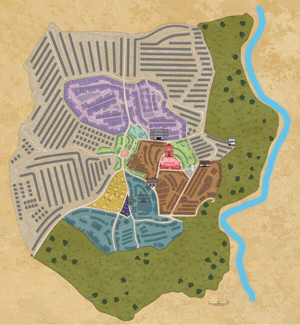
Trellech presents a very different map challenge. While the magical Trellech is based on a real place (read about the history of Trellech), the current layout looks very little like the early medieaval layout other than the locations of some roads.
Explore the map of Trellech here. It includes:
- Descriptions of the different areas of the city (colour coded on the map, and described in detail in the text of the Trellech page for people who prefer text description.)
- Residences (mixed and upper class)
- The Albion Museum (as seen in Pastiche).
- Vivian Porter’s office (Goblin Fruit and Fool’s Gold)
- The Scali bank and house ( Fool’s Gold)
- The Temple of Healing (Carry On)
- Trellech Library (Wards of the Roses)
- The Guard Hall (Pastiche in particular)
- Club Row
- The Ministry Quarter